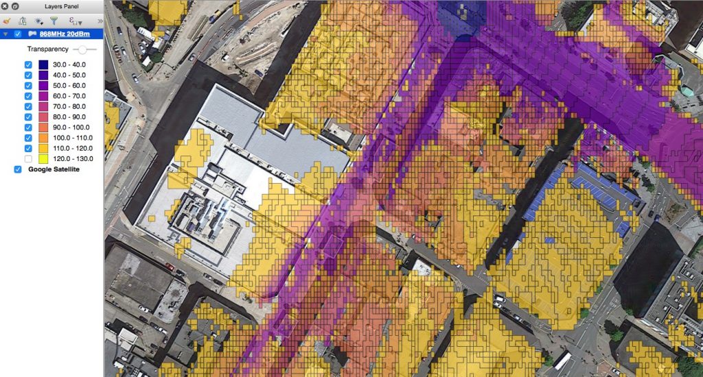
CloudRF SHP in QGIS
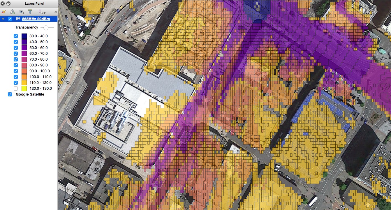
Exporting your data to a GIS platform such as ESRI Arcmap or QGIS allows you to tightly integrate RF coverage layers with other business intelligence such as customer locations.
The TIFF and SHP export formats offered by the expert plan will let you open the layers in a GIS platform. For maximum control over styling you can choose a greyscale colour key called ‘Greyscale GIS’ within the interface or API (col=9) which has a different numeric value for each dB level. This high level of granularity means you can style your shape file to the nearest dB.
Styling CloudRF shape files in QGIS 2.18
- Create your coverage layer using the greyscale GIS colour schema.
- Download the layer as an ESRI shape file (SHP) and open in QGIS
- Right click the layer and open its properties, then ‘style’
- Change the type to ‘Graduated’ then pick a colour schema or define your own
- Click classify to load in the dB/dBm values. Note that a negative -60dB value will be (+)60 due to the way the levels are represented as positive grey pixel values.
