ADS-B flight tracking
Our VHF propagation models, global terrain data and generous distance and height limits make us a popular choice for modelling aircraft. We already have an ADS-B integration for tracking live aircraft on our Github site.
BVLOS route planning
Flying a drone beyond visual line of sight (BVLOS) requires careful planning. Our API can be used for modelling both cellular and UHF radio links to maintain communications with a UAS platform and identify risks ahead of time.
Camera siting tool
We do more than radio. Our Line of Sight (LOS) model when used with buildings data or LiDAR delivers an accurate, global, siting capability for a camera. For this reason we are used for siting large networks of Ski cameras in the Alps.
DMR / LMR radios
We have templates for popular DMR radios such as Motorola’s MOTOTRBO series. With Signal-to-Noise ratio and our noise API, you can model DMR and LMR reception in challenging urban environments.
Extreme links
By request we have extended our distance limits to support high altitude aircraft and stratospheric / ionospheric communications. The public service can go out to 500km radius for a long range link.
FWA planning
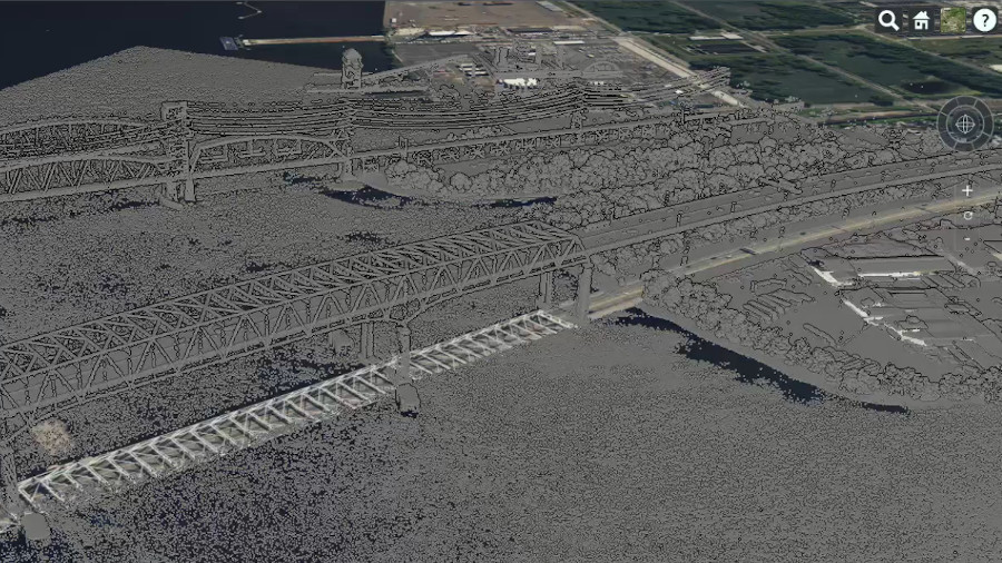
Fixed Wireless Access (FWA) is a growth market which requires LiDAR data, or an equivalent accuracy, to deliver useful planning in busy suburbs and cities. As the original online-LiDAR-accurate planning tool we know the limitations well which is why we’ve approached this problem with a global perspective instead of some puddles of USGS public data: We can guarantee global 2m buildings data where others can not as well as quality LiDAR in select cities and countries. You can see for yourself on our coverage map.

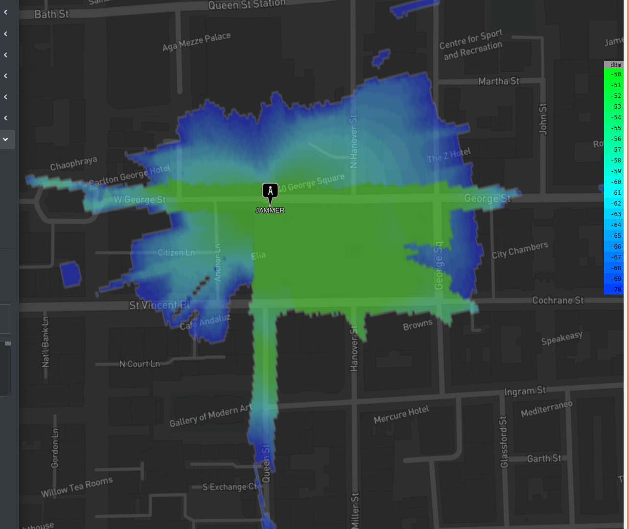
GPS jamming
GPS jamming and spoofing is a modern problem with a potentially devastating impact yet it is hard to visualise the risk. With our API you can model the impact of GPS jamming from both the transmitter’s and receiver’s perspective. Better still, you can scale this with our API to conduct automatic Monte Carlo assessments of different profiles such as altitude. Smart scientists use our API to do the repetitive work so they can work on something else.
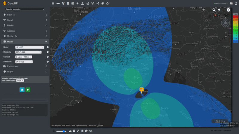
HF NVIS
We have a HF NVIS propagation model with configurable ionosphere refraction heights for the D, E and F layers.
LoRa gateways
We are probably the busiest LoRa modelling API on the internet. We’re used by many big name projects for agriculture, smart farms, smart cities and sensors. This LPWAN protocol is so popular we have added modulation options for LoRa spreading factors into our interface.
LTE coverage
We’re very accurate for LTE due to our extensive field testing with this medium. LTE has an extreme cell range of 100km which our GPU engine can handle without issue at high resolution. With Bullington and Deygout diffraction we can model the coverage of LTE800 into the many dark corners where other protocols cannot reach.
MANET networks
We have templates for popular MANET radios and Waveforms from DTC, Persistent Systems, Silvus and Trellisware. Our API has been integrated directly into Trellisware radios so we can use live radio data for effortless planning.
Our Multisite API allows many radios in a network to be modelled quickly in one request. This scales well using a GPU so you can model 160 radios in one go if you wish. This is the basis for our MANET planning tool in the web interface which shows both links and coverage. With the noise API, it can be optimised further to show local noise figures at each location.
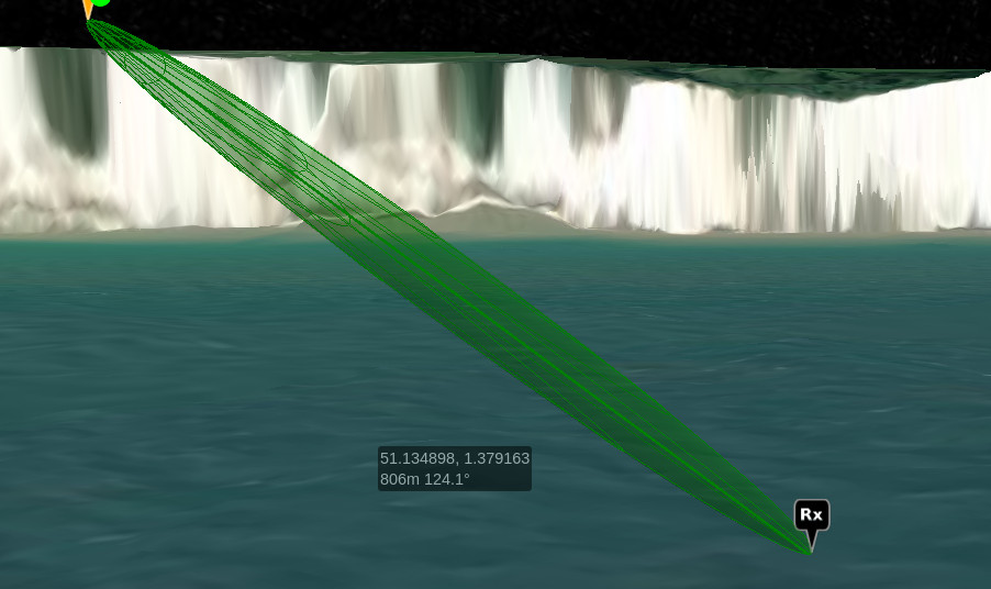
Microwave Planner
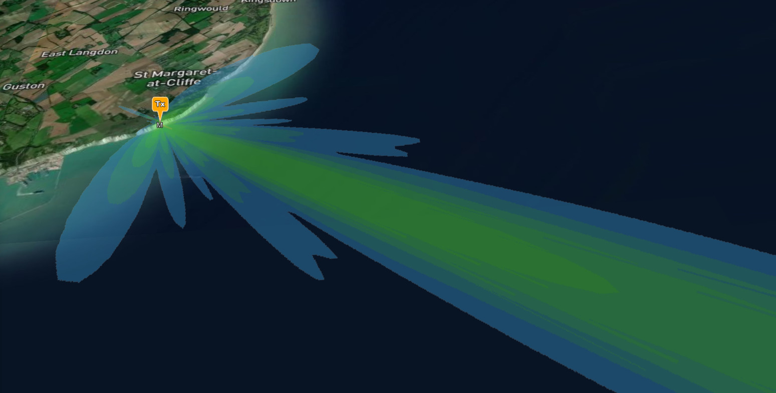
For Microwave planning, we have detailed link reports with recommendations for fresnel clearance. In the web interface, the fresnel zone is displayed as a 3D mesh to improve situational awareness and styled based upon clearance. With a 500km maximum range, 3D antenna patterns and configurable downtilt, you can model extreme links, up until the radio horizon.
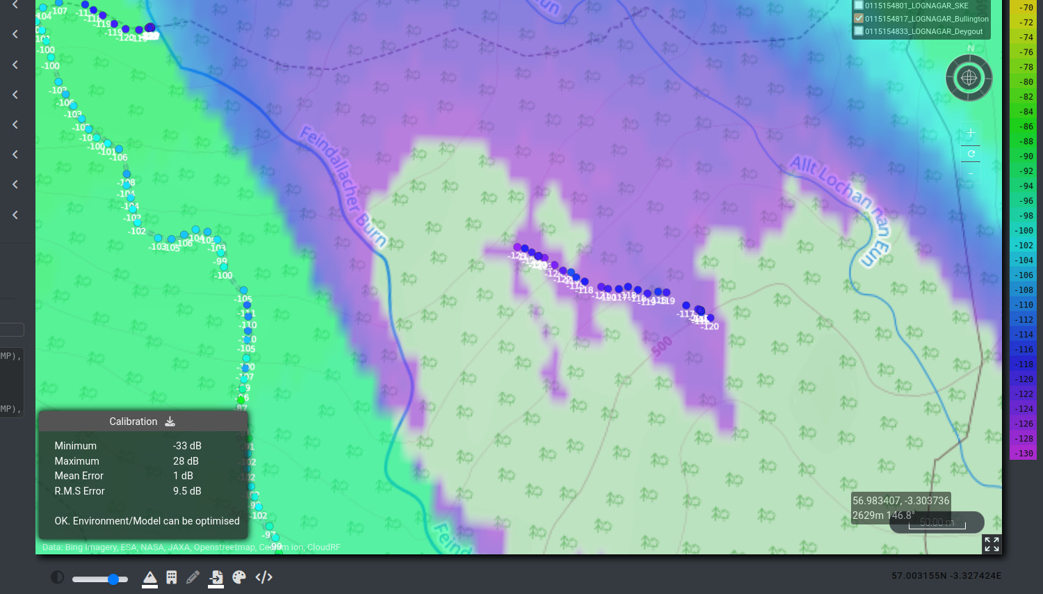
PtP Link Simulator
For point-to-point links we have a dedicated path profile analysis API and tool in our interface. This powerful and unique API will return verbose detail about obstructions and clutter along a path in a rich data format which you can plot into a chart. We also offer the data as a ready made PNG chart and 3D KMZ download.
The link tool in the interface is as easy as clicking upon the map.
RADAR simulation
Simulating a RADAR might seem easy if you have a line of sight tool but doing it properly requires a lot more: With a dedicated bi-static RADAR path loss model, we can model different RADAR cross sections ranging from a small drone to an oil tanker. Our model has been calibrated against industry calculators and implemented into planning systems via our API.
Receiver range
Modelling a receiver’s range is perfectly possible when the parameters are known. By transposing the transmitter location for the receiver and using the transmitters’ signal parameters, a “good enough” simulation can be created.
If the transmitters’ power levels (and locations) are unknown then a path loss (dB) map can be created instead based upon the receiver’s sensitivity. This will show all possible locations and can be referenced once more information is known to reveal likely locations. This is how our Trilateration API works.
RF Planning
For general RF Planning, our technology and vendor agnostic platform is ideal. We have path loss models, antennas and settings for everything from a Bluetooth low energy beacon up to a high power airport RADAR.
For sub GHz planning we excel at modelling attenuation through and beyond soft obstacles. This is the harder problem after LOS analysis which we specialise in.
Satellite line of sight
We have a database of over 6000 active satellites and can do LOS planning to anywhere on earth from a chosen satellite. Not only can we use terrain but we can also use precise ground clutter and buildings to show obstacles in a city for example. Both Geo-stationary and LEO orbits are supported.
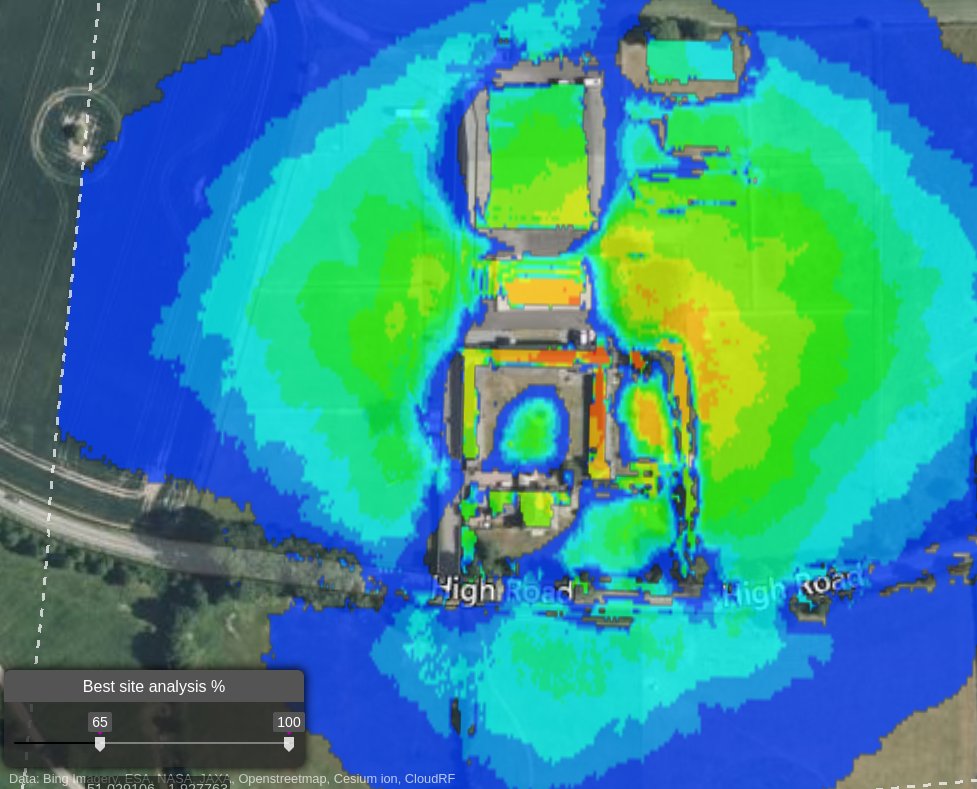
Starlink line of sight
Starlink and other NTN services are great when you have good visibility of the sky. They don’t work nearly as well in urban canyons as they need to see satellite trains at low angles.
Our GPU accelerated Best Site Analysis (BSA) capability performs a thorough Monte Carlo study of a user defined area to recommend the best and worst sites for a Starlink Dish. The heatmap can be interpreted as throughput speed: The hotter areas will get a faster, and more consistent, connection than the colder areas. Stay away from tall buildings unless you are upon them!
VHF coverage
Whether by Air, Land or Sea we support all VHF communications. With a ceiling of 60,000m for high altitude aircraft and balloons, and a maximum range of 500km we can do extreme predictions.
We have the Egli VHF model with Bullington and Deygout diffraction, the ITM model with integrated Vogler diffraction and ITU path loss models to ensure you can match your VHF system.
Wi-Fi planning
For WLAN networks we have outdoor antennas and templates for market leaders such as Cambium Networks and Ubiquiti. As a vendor agnostic platform, we support hybrid networks using different equipment and won’t try and upsell you hardware. We have global buildings data for accurate urban planning and LiDAR data for select countries and cities which you can review on our map.