Satellite communications are readily accessible, unless you live in a polar, mountainous or dense urban area.
Using our modelling API and third party satellite data courtesy of CELESTRAK, we are able to determine if a chosen satellite is visible from a given point on earth. Unlike “satellite finder” apps, we can provide a lot more than a location in the sky. Our tool can:
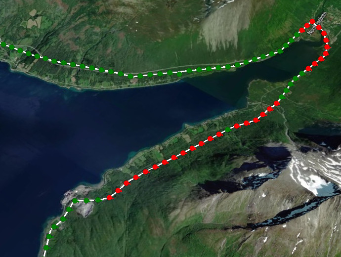
- Show if the view is obstructed or not
- Show the azimuth and elevation toward the satellite upon a 3D map
- Consider ground clutter such as buildings and trees
- Consider the fresnel zone clearance based upon the frequency (A UHF signal can have a 50m fresnel zone at 10km)
- Consider the location at a given time for LEO satellites (Starlink, OneWeb etc)
Route analysis

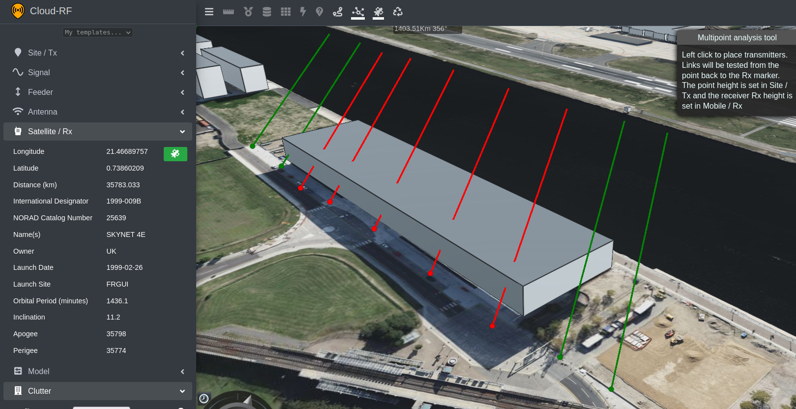
Points analysis

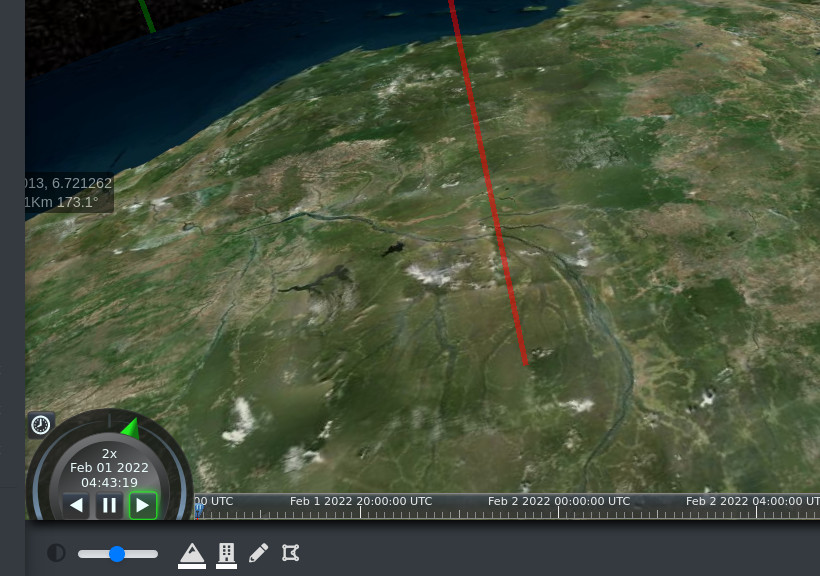
Time based analysis for LEO
Low Earth Orbit satellites move fast at a relatively low altitude. For this we can select a time.
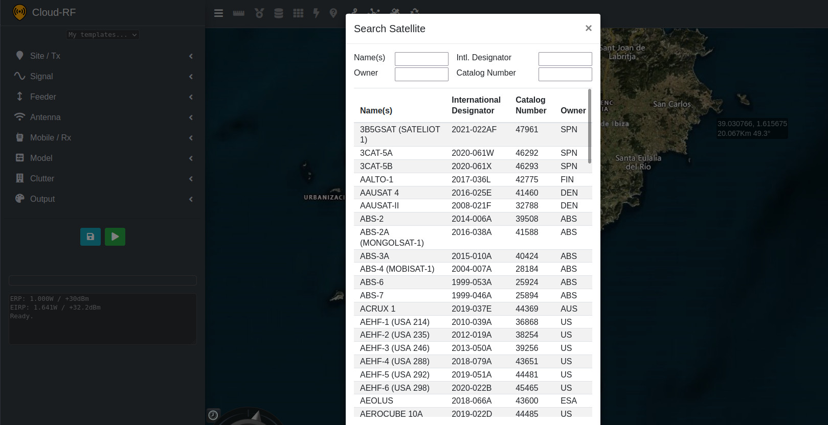
Searching for a satellite
The CELESTRAK database has every satellite, going back to Sputnik 1 in 1957. We have filtered active satellites which you can search by name or NORAD designator.
Urban?
We have global 3D buildings and 10m Landcover so you can model obstacles. You can also draw your own obstacles using the custom clutter tools.
More information
Instructions for using the tool are in the documentation.
A premium (Silver or Gold) plan is required to use this functionality. If you are an integrator and would like to build your own interface using our powerful modelling API this is encouraged, and will save you years of R&D and expensive hosting.
You can get the satellite TLE data over at CELESTRAK.
API schema is here: https://cloudrf.com/documentation/developer/swagger-ui/
