 Land Cover or ‘clutter’ data describes obstacles on the earth’s surface a radio wave will have to negotiate like trees or buildings.
The Land cover data is layered on top of the terrain data which can be either a smooth(er) Digital Terrain Model (DTM) or a rougher ground-with-clutter ‘Digital Surface Model’ (DSM) . For DTM and DSM this will allow you to simulate attenuation from a forest or city where it might not otherwise be represented in the data resulting in much more accurate results. It also means you can enhance basic coarse terrain data with fresh high resolution land cover to reflect recent construction developments.
Land Cover or ‘clutter’ data describes obstacles on the earth’s surface a radio wave will have to negotiate like trees or buildings.
The Land cover data is layered on top of the terrain data which can be either a smooth(er) Digital Terrain Model (DTM) or a rougher ground-with-clutter ‘Digital Surface Model’ (DSM) . For DTM and DSM this will allow you to simulate attenuation from a forest or city where it might not otherwise be represented in the data resulting in much more accurate results. It also means you can enhance basic coarse terrain data with fresh high resolution land cover to reflect recent construction developments.
Obstacles and attenuation
Radio waves are attenuated differently by different materials like vegetation and man-made buildings. The impact varies by frequency with very short wavelength signals like WiGig at 60GHz struggling to penetrate a paper wall whilst a long wavelength VHF signal can breeze through multiple brick walls. For accurate modelling its essential that land cover is considered otherwise you run a risk of an unrealistic prediction which will bear little resemblance to real world results.Trees
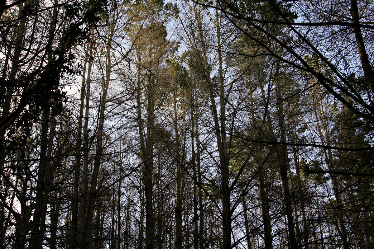 Trees attenuate differently with dense coniferous pine forests attenuating the most.
An ITU standard, ITU-R P.833-7 “Attenuation in Vegetation” exists to describe the impact of a forest of different signals. There have been many academic studies into this subject but the summary of this standard for a mixed deciduous/coniferous forest is as follows:
Trees attenuate differently with dense coniferous pine forests attenuating the most.
An ITU standard, ITU-R P.833-7 “Attenuation in Vegetation” exists to describe the impact of a forest of different signals. There have been many academic studies into this subject but the summary of this standard for a mixed deciduous/coniferous forest is as follows:
| Frequency MHz | Attenuation dB/m |
|---|---|
| 106 | 0.04 |
| 466 | 0.12 |
| 949 | 0.17 |
| 1852 | 0.3 |
| 2118 | 0.34 |
Buildings
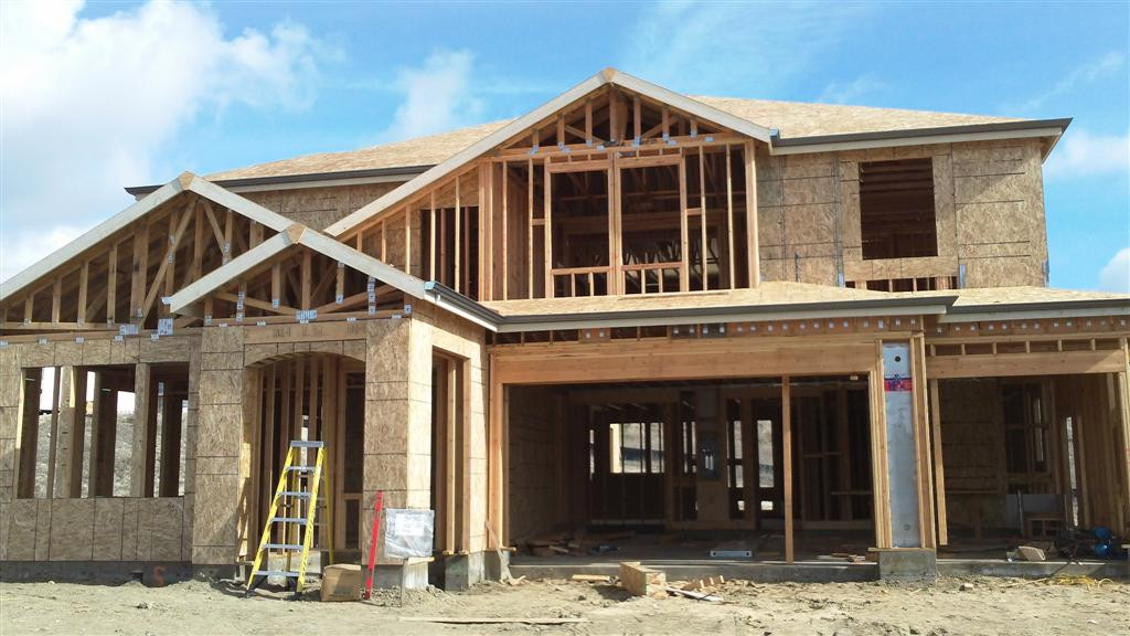 Man-made buildings are even less predictable due to the variety in size, density and materials used. Many studies have been conducted into building attenuation but they are region specific due to construction materials and designs. A good reference is a UK paper by OFCOM which merges multiple research papers and has a useful table of attenuation by material and frequency on page 39.
| Material | Attenuation dB/m at 1GHz | Attenuation dB/m at 10GHz |
|---|---|---|
| Concrete | 24 | >50 |
| Brick | 32 | 32 |
| Plasterboard | 11 | >50 |
| Wood | 5 | >50 |
| Glass | 3 | 44 |
| Ceiling board | 1 | 10 |
| Chipboard | 22 | >50 |
| Floorboard | 4 | >50 |
Land cover data
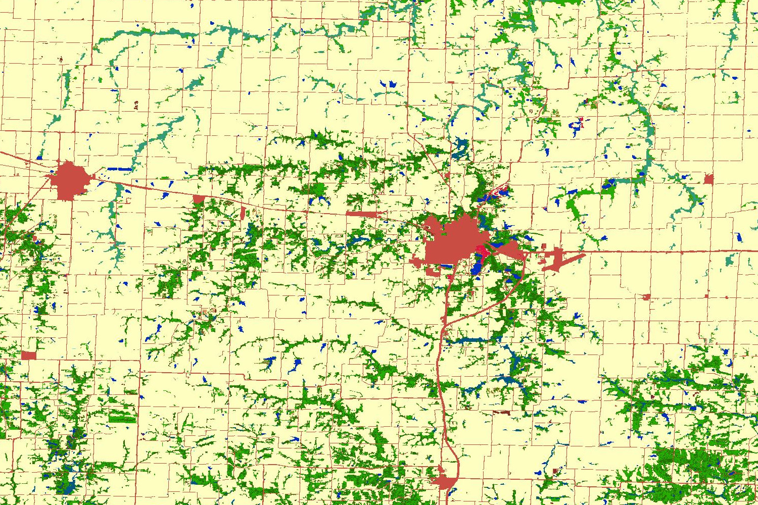 To enhance DTM and DSM models with 3D clutter, Land Cover data can be layered on top of the terrain to apply representative attenuation. This Land Cover data has been sourced from a variety of sources with up to 30m resolution. The total possible resolution possible is determined by the highest resolution data so if you are in New York City for example where there is 2m LIDAR / DSM data available, your effective resolution will be 2m.
 30m Digital surface model | 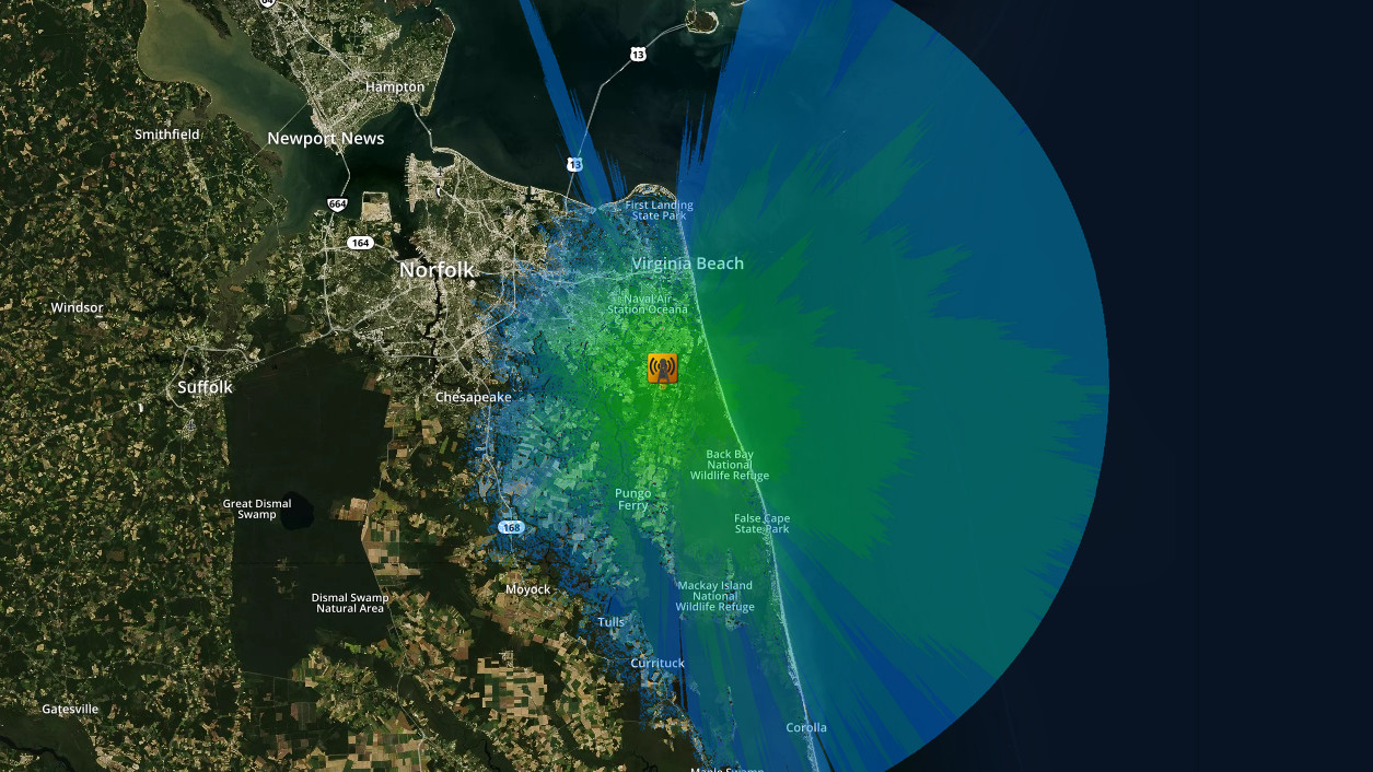 30m Digital surface model plus 30m land cover |
 2m Digital surface model (LIDAR) | 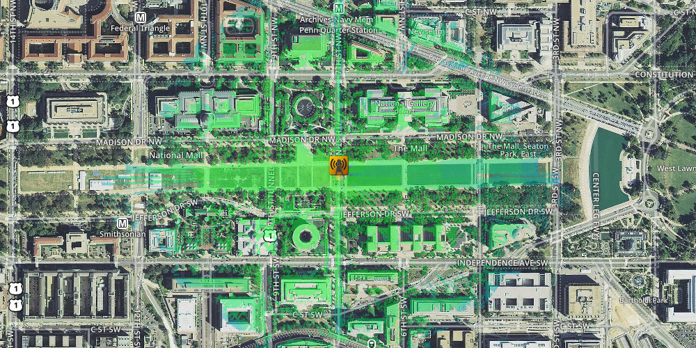 2m Digital surface model (LIDAR) plus 30m land cover |
Propagation models
Propagation models vary in complexity from the simple ‘one liners’ like the free-space-path-loss model to the incredibly complex Irregular Terrain / Longley Rice model. Most models are simple and must be used within their parameter limits (especially with empirical ‘measured’ models) otherwise you could get wildly inaccurate results. A good example is the well known Hata model which was designed for elevated cellular base stations serving mobile subscribers which were lower than it. If you use this model at the bottom of a hill you can get some incredibly unlikely results as the simple model has no concept of terrain only A to B. By using Land cover, the output from these simple models can be enhanced greatly to provide a result which is sensitive to changes in the terrain along a given path, similar to how the ITM model works.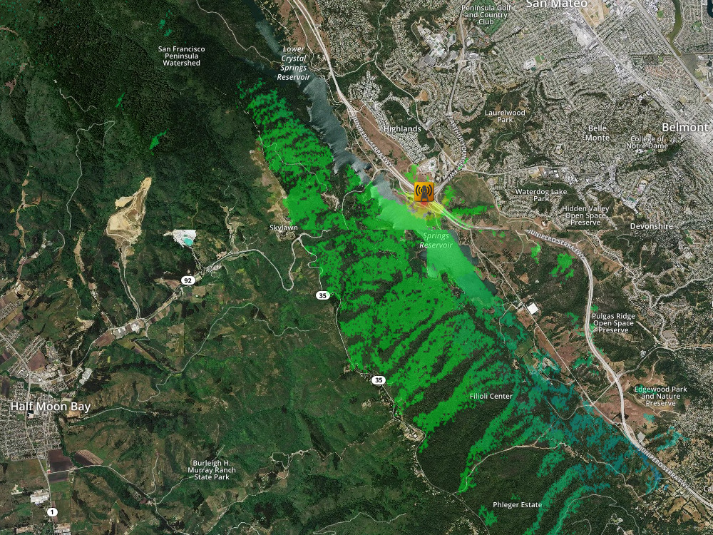 | A UHF repeater at the foot of some hills with 20m DSM only. By default the Sleipnir engine will restrict coverage to line-of-sight for simple models like Hata.
|
 | With knife-edge-diffraction enabled, the Hata coverage is free to roam beyond line-of-sight. The coverage becomes very optimistic to the west up in the hills as Hata has no concept of terrain and expects a clear shot from the base station to the mobile station.
|
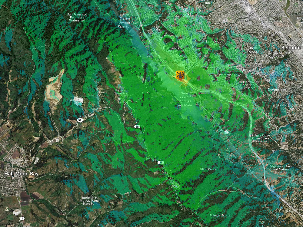
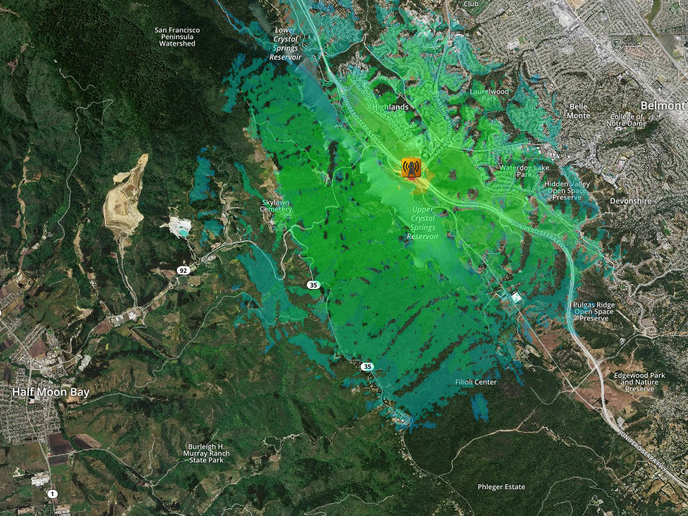 | With knife-edge and 30m Land cover enabled, the optimistic Hata coverage is still free to roam beyond line-of-sight but is now severely constrained by the dense forests and urban developments without modifying the model itself.
|
Forest example
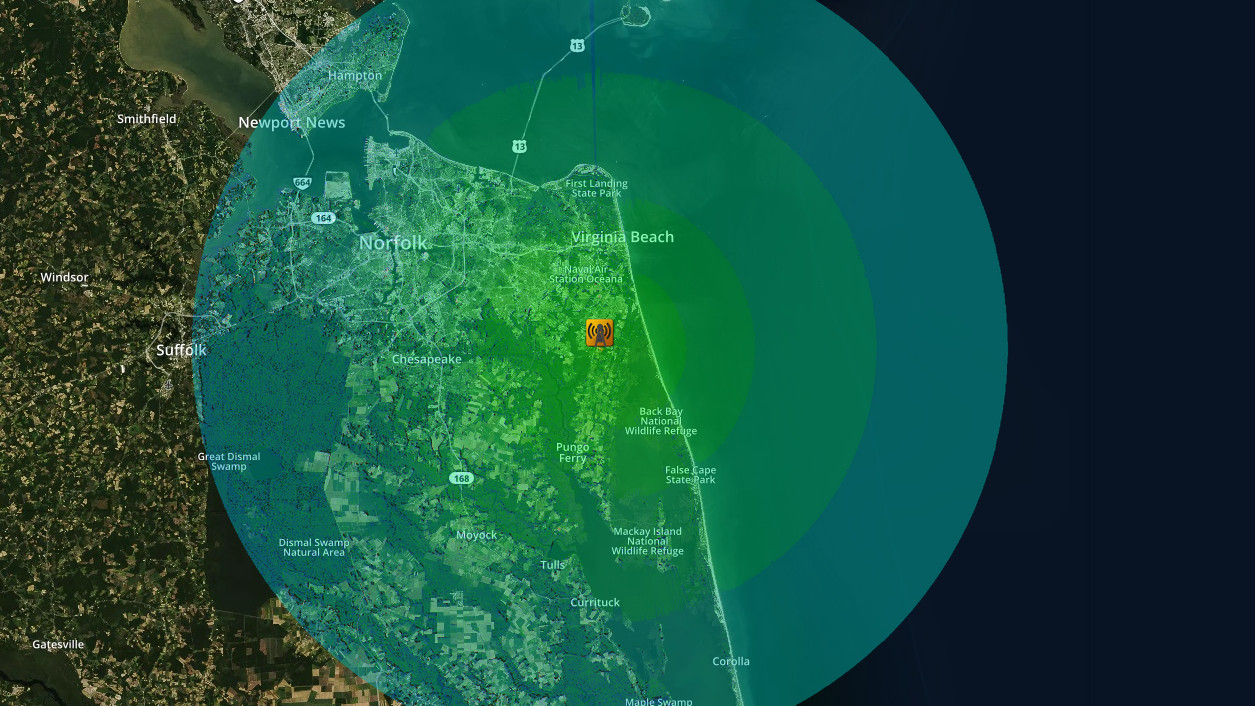
Modelling little forest blocks far away from your tower is easy with accurate DSM data but modelling a huge forest where your tower is within it is a harder problem. Heights are all defined as relative to the ground so if you have a 10m tall forest which is represented as raised earth in a DSM model and your tower is 12m tall you will end up with a tower which is in fact 22m above the ground – not ideal! Instead, when working with the 30m DSM you should define your height as the height above the canopy which is 2m. Here’s a comparison using 30m DSM and 30m Land cover in west Virginia.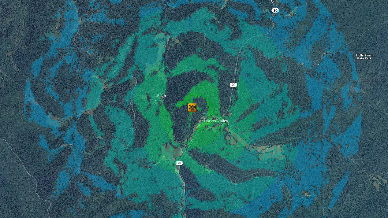 Free space path loss prediction for an outdoor WiFi router, 30m DSM. | 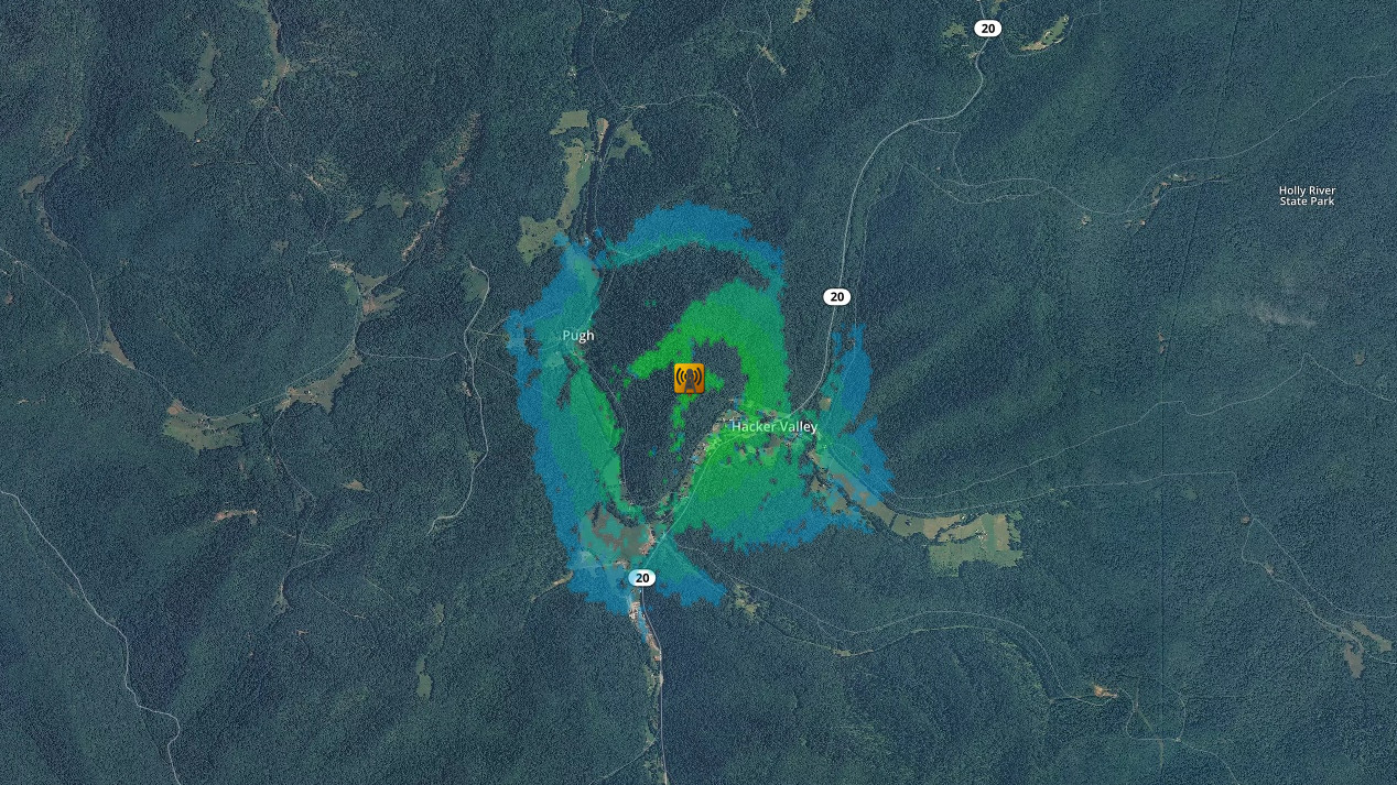 30m DSM plus 30m Land cover. |
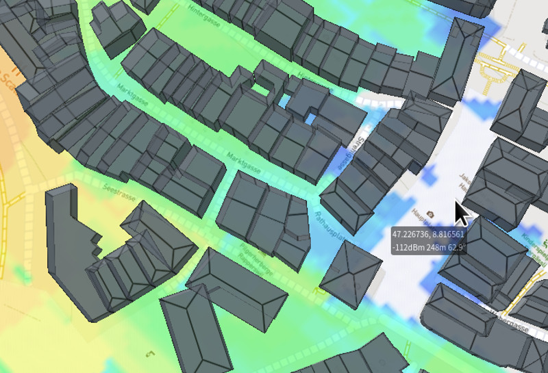
Urban example
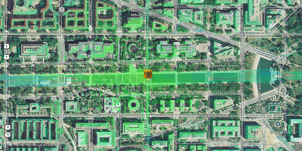
To demonstrate the attenuation of buildings, this example has an emitter (LTE eNodeB on 800MHz) equidistant between a city and some countryside. The attenuation of the urban land cover becomes obvious once applied which contrasts with the open fields and water. Free space path loss prediction for an LTE eNodeB, 30m DSM | 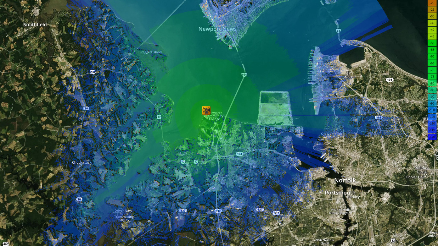 Free space path loss prediction for an LTE eNodeB, 30m DSM with 30m Land cover |
