


Google Earth™ Interface
The Google Earth interface is a unique and powerful radio planning plugin for Google Earth™.
The software is entirely server based so end users only need to open a Keyhole Markup Language (KML) overlay in Google Earth to use it.
It’s ideal for organisations already using Google Earth as it can be deployed rapidly to users as a URL and the KML output is visualised along with 3D terrain and existing data layers, for example network infrastructure.
The system’s terrain data, radio templates, antenna patterns and ground clutter are all managed server side.
Requirements
Windows, Linux or Mac
Google Earth Pro
Web browser with Javascript and cookies enabled
Internet connection
Google Earth Settings
Within Google Earth options, ensure the following are set:
Memory cache: 50Mb
Disk Cache: 2000Mb
Errors: Show prompts for all errors
Placemarks: Allow access to local files and data
Cookies: Save cookies to disk
Setting a large disk cache and small memory cache means more imagery is saved to your computer so you can view layers offline.
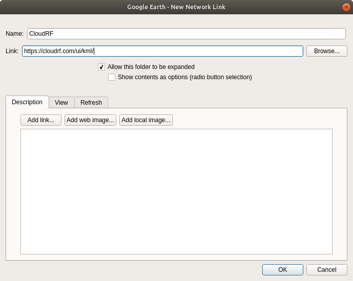
To open it, add a network link in Google Earth for https://SERVER/ui/kml/ where SERVER is either cloudrf.com for the public service or your server’s IP address for a private server.
Authentication
Authentication is required to control access to the service and ensure a higher and more personal quality of service for all. When the layer is opened for the first time, an authentication dialogue will appear prompting the user to enter a username and password.
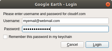
Once opened, you will be prompted for a username and password.
After that you will receive several sub-layers providing different functionality or reference data.
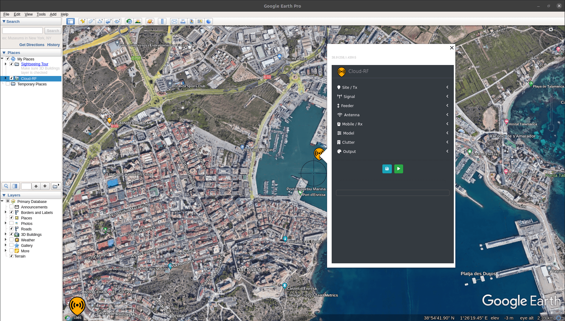
Operation
Crosshairs will be visible in the centre of the view and mark where your site/tower will be. To perform a new calculation, click the floating marker in the middle of the map screen to open up a pop-up form, then enter system and environmental parameters and finally click a button to initiate calculation of the result. The variables are all passed to the API for processing. The server produces the overlays and then displays a KMZ file link which needs to be clicked to be viewed.
The KMZ can also be opened in other GIS applications which support KML 2.2.
Inputs
The input settings for the form are exactly the same as the web interface which are described here.
Known issues
Marker is Offset
The centre of the map is determined by the screen bounds so you must be looking straight down, not an oblique angle. You can still fly around later but for accurate planning ensure your view is perpendicular.
Solution
In settings, ensure you uncheck automatically tilt the view when going close to the earth.
The Red “X” of Doom
Google Earth had an update between 7.1.8 and 7.3 which changed KMZ handling in the name of security.
KMZ and “missing files” issues feature in change-log messages around this time.
A KMZ file with zipped content would be repackaged and the content hyperlinked to the domain from where it came. This results in a big red cross.
Solution
Fetch your KMZ files with a browser. Download them to your computer and you can then work with them as before.
This is as simple as visiting your archive, downloading the KMZ files and then you can open them in Google Earth. Google Earth doesn’t know which domain the files came from so trusts them as ‘local’ files.