Footer
The floating info tray at the lower-left of the map shows the cursor position and any distance/signal readout. It appears while the pointer is over the map and moves to the map edge when the left sidebar is closed.
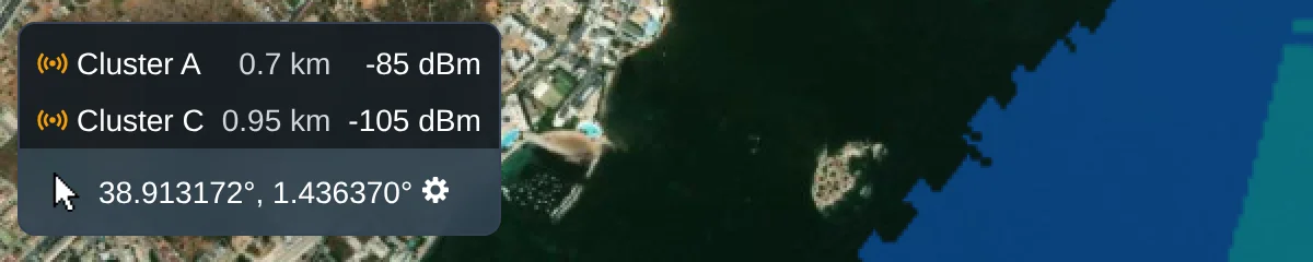
Cursor Position
The tray shows the cursor's latitude and longitude live as the pointer moves over the map. Select the cog beside the coordinates to switch the display between decimal degrees (DD), degrees/minutes/seconds (DMS), and MGRS.
Distance/Signal Viewer
Where calculated coverage is available, rows above the coordinates identify each radio or network contributing a signal at the cursor. Radio rows also show the distance from the radio to the cursor. The currently selected radio or network remains in the list; click that row to frame it on the map.
A network only contributes a single row when its coverage is combined - see Mesh and merge heatmaps.