CSV Files
You can import a list of sites from a CSV file. Each row in the file becomes a radio in your project.
Importing
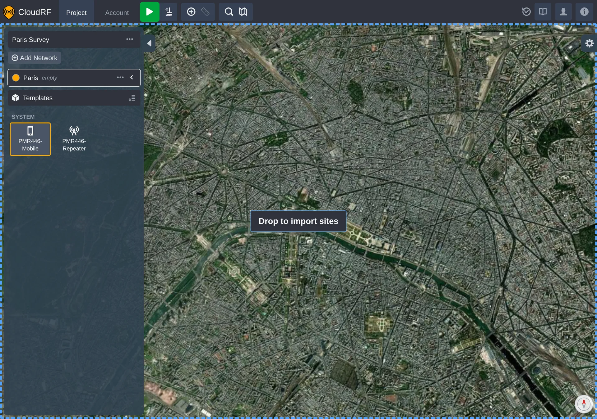
Drag a .csv file onto the map of an open project.
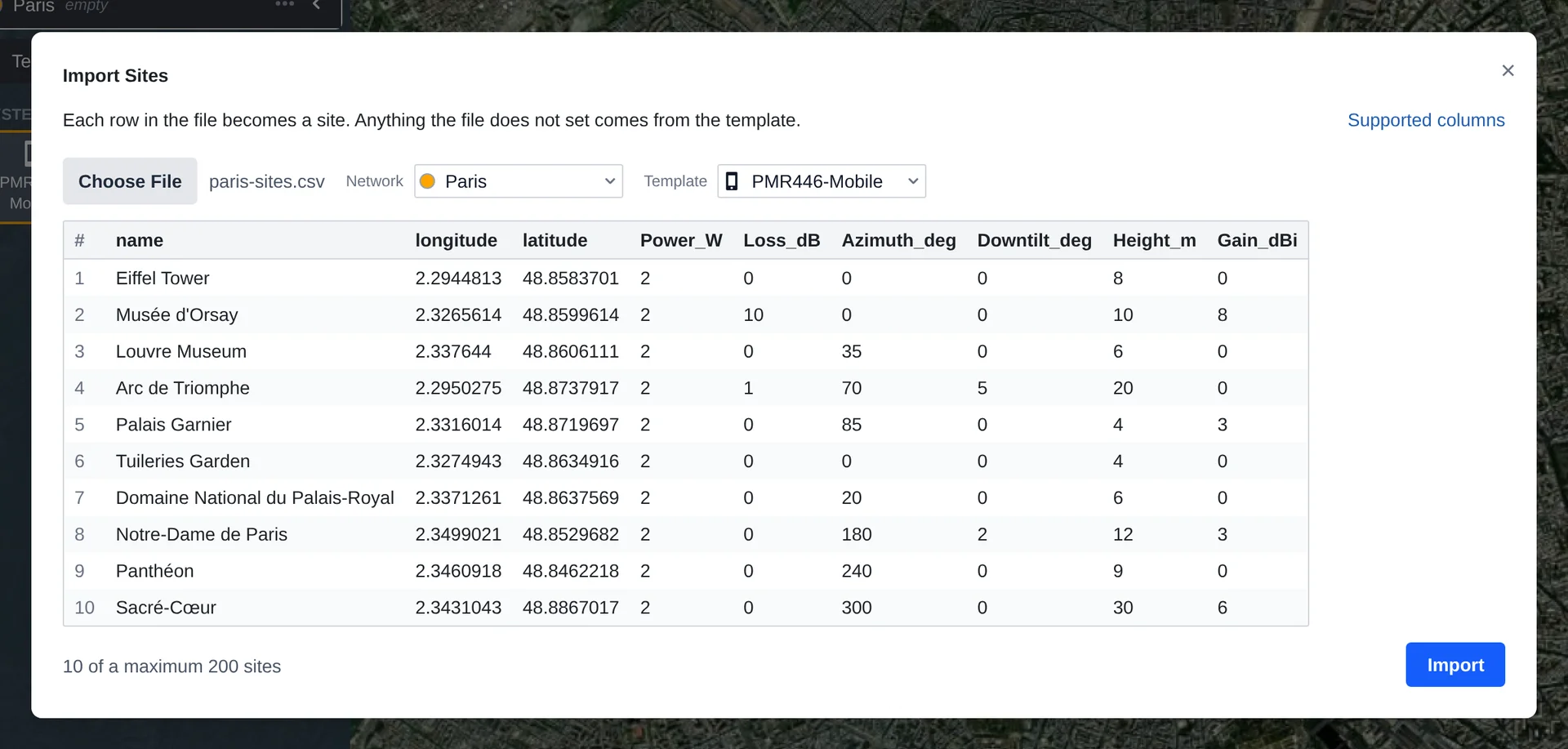
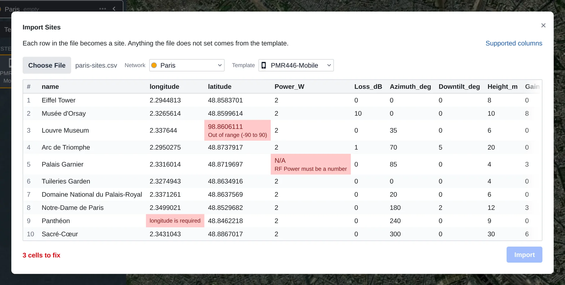
The import dialog shows you the rows it read from the file, and asks you to choose:
| Choice | Effect |
|---|---|
| Network | The network the new radios are added to. If the project doesn't have one yet, importing creates it. |
| Template | The template the new radios are based on. Anything the file doesn't set is taken from it. |
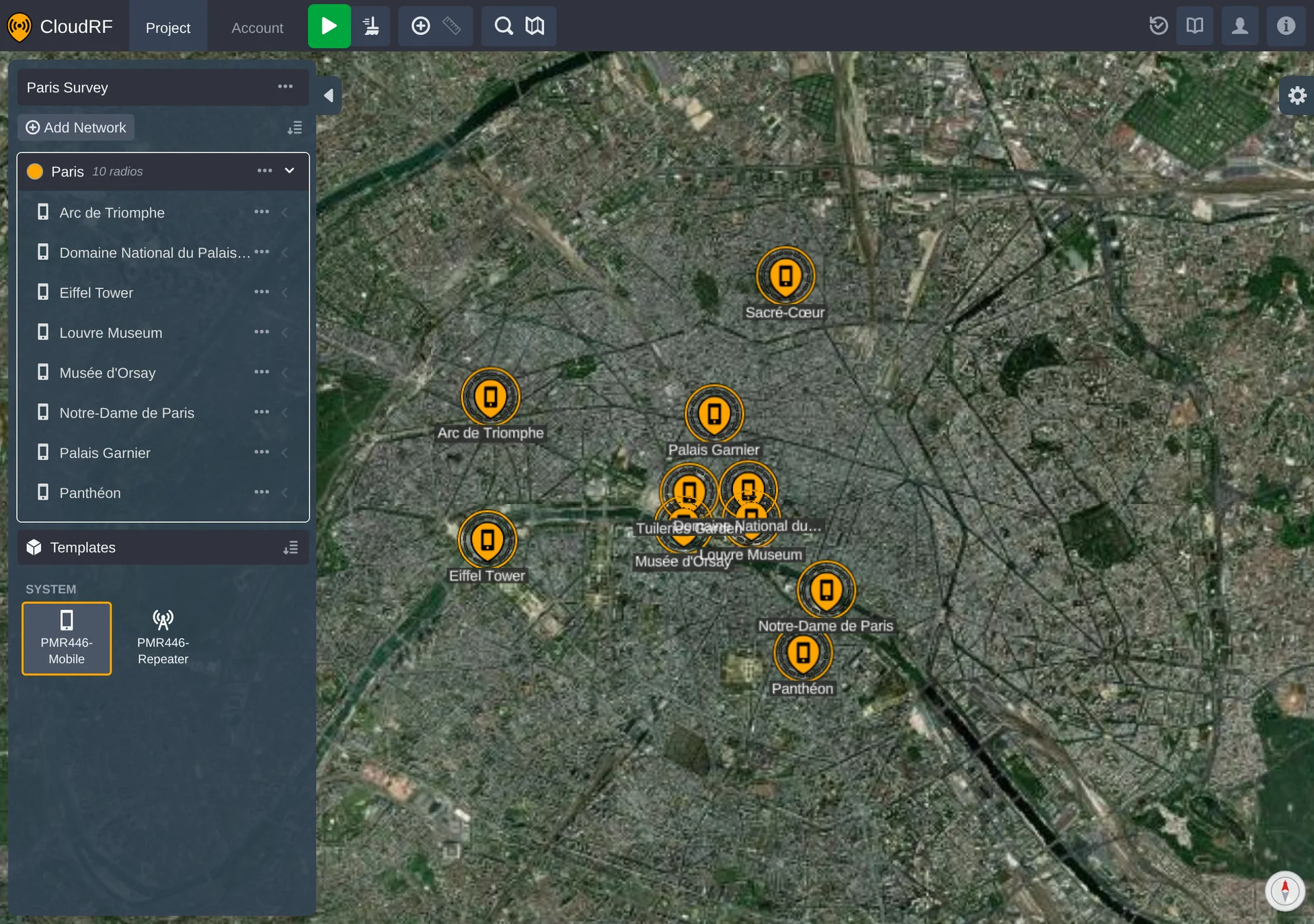
When you import, the radios are added to the network and the map moves to show them.
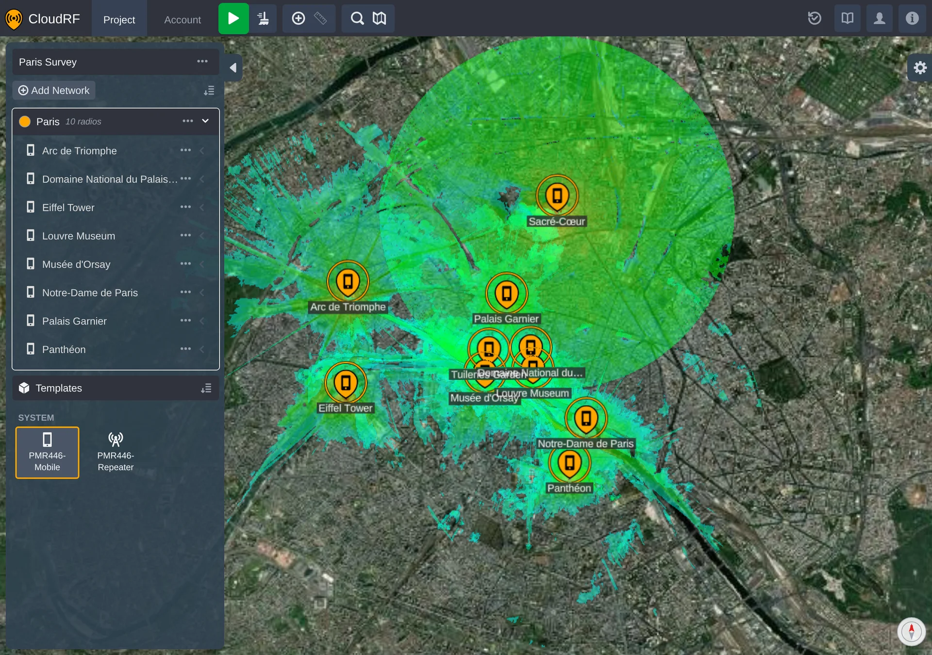
Nothing is calculated at this point. The imported radios have no coverage until you press Calculate.
What a File Needs
Every row needs a latitude and a longitude. Every other column is optional - if you leave a column out, or leave one of its cells empty, the radio uses the template's value instead.
Columns that aren't in the table below are ignored, and won't appear in the dialog. A file can hold up to 200 rows.
Column names aren't case sensitive, and spaces and underscores are interchangeable, so Power_W,
power w and POWER W all mean the same thing.
When a Cell Is Wrong
The dialog highlights any cell it can't use and explains what's wrong with it. You can't import until every highlighted cell has been fixed.
Columns
Each column below sets one field of a radio's settings.
| Column | Sets | Accepts |
|---|---|---|
Name or Site | Name | Any text |
Latitude | Position | -90 to 90. Required |
Longitude | Position | -180 to 180. Required |
Height_m | Height above ground | 0.1 to 120000 |
Frequency_MHz | Frequency | 2 to 100000 |
Bandwidth_MHz | Bandwidth | 0.001 to 200 |
Power_W | Transmit power | 0.001 to 5000000 |
Loss_dB or Antenna_Loss_dB | Feeder loss | 0 to 90 |
Gain_dBi or Antenna_Gain_dBi | Antenna gain | -30 to 60 |
Azimuth_deg or Antenna_Azimuth_deg | Antenna azimuth | 0 to 359 |
Downtilt_deg or Antenna_Tilt_deg | Antenna tilt | -90 to 90 |
Antenna_Horizontal_Beamwidth_deg | Horizontal beamwidth | 1 to 360 |
Antenna_Vertical_Beamwidth_deg | Vertical beamwidth | 1 to 360 |
Front_to_back | Front-to-back ratio | 0 or more |
Antenna_Polarisation | Polarisation | V or H |
Antenna_Pattern | Antenna pattern | An antenna's name, or Custom |
Receiver_Height_m | Receiver height | 0.1 to 120000 |
Receiver_Gain_dBi | Receiver gain | -30 to 60 |
Receiver_Sensitivity_dBm | Receiver sensitivity | Any number |
Noise_floor_dBm | Noise floor | Any number |
Measured_units | Measured units | A name the Output panel lists |
Colour_schema | Colour schema | A name the Output panel lists |
Model | Propagation model | A name the Model panel lists |
Diffraction | Diffraction model | A name the Model panel lists |
Context | Context | 1, 2 or 3 |
Reliability | Reliability | A value the Model panel lists |
Profile | Clutter profile | A profile's name |
Where a column takes a name, use the name as it's written in the settings panel - for example
Deygout 94, Received Power (dBm) or General Purpose VHF/UHF/SHF.
Example
name,longitude,latitude,Power_W,Height_m,Azimuth_deg,Gain_dBi
North Mast,2.2944813,48.8583701,2,8,0,0
Depot,2.337644,48.8606111,2,6,35,0
Hilltop,2.3431043,48.8867017,2,30,300,6
To import a whole project rather than a list of sites, see PNUT Files.